Erin Downgraded to Formidable Category 4 Hurricane
The US National Hurricane Center updates on Hurricane Erin's current status and projected path.
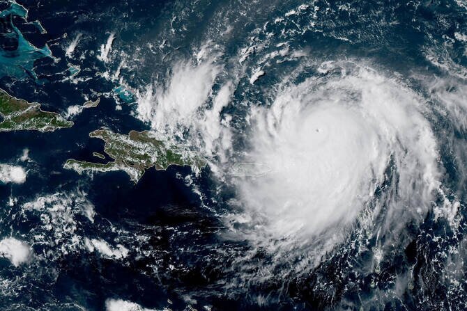
Hurricane Erin, the first hurricane of the 2025 Atlantic season, has been downgraded from a Category 5 to a formidable Category 4 storm according to the latest update from the US National Hurricane Center.
The downgrade occurred as the wind speed eased slightly to maximum sustained winds of 225kph, from an initial estimation of 160 mph.
Erin is currently located approximately 636km east of Grand Turk Island and is moving west-northwest at nearly 14 mph.
A turn more northward is expected to occur on Monday into Tuesday, taking the storm's center past the northern Leeward Islands, the Virgin Islands, and Puerto Rico through Sunday, then east of the Turks and Caicos Islands and the southeastern Bahamas on Sunday night and Monday.
The National Hurricane Center advises that heavy rainfall is expected in the northern Leeward Islands, the Virgin Islands, and Puerto Rico through Sunday due to the storm.
Swells generated by Erin are also anticipated to impact portions of these regions along with Hispaniola and the Turks and Caicos Islands throughout the weekend, before extending to the Bahamas, Bermuda, and parts of the East Coast of the United States early next week.
The Bahamas has issued a Tropical Storm Watch for the British islands southeast of it in anticipation of Erin's approach.
Concerns about wildfire risks have also been raised due to the potential combination of human-caused sparks with parched vegetation under strong dry winds, particularly if Erin strengthens further into a powerful offshore storm fueled by cold and warm air masses colliding rather than tropical seas.
Despite these concerns, insurance-linked securities manager Twelve Securis has noted that Erin is expected to remain sufficiently offshore to prevent significant impacts on the US East Coast.